|
Methods of fire situation analysis
|
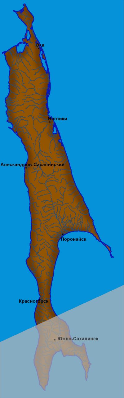
| | Pic. 1. Area of Sakhalin Island covered in fire analysis.
Clic picture for detale map (45 Ęá)
|
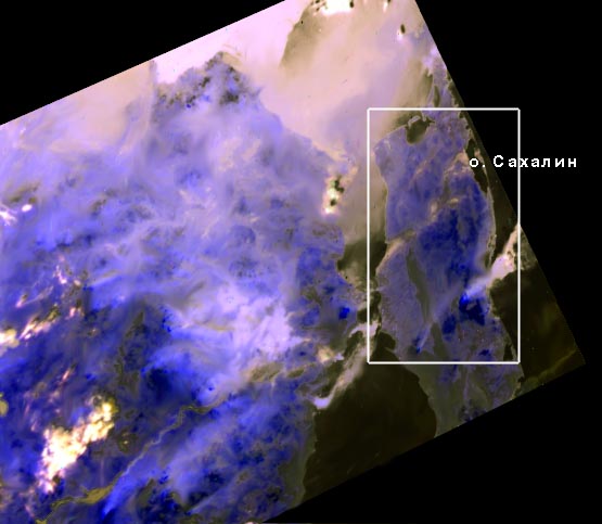
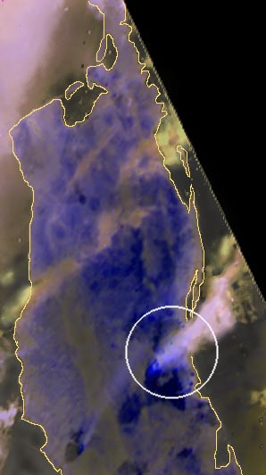
Analysis of the fire situation on Sakhalin and the Far East was carried out by R&DC ScanEx, specializing in satellite image processing, at the request of Greenpeace Russia. Satellite images from Resource-01 and NOAA satellites were used in the study. Scanners of Resource-01 satellites are capable of receiving 2-4 channel spectral images with average resolution (150 meters) and a field of vision of 600 km from East to West. They also produce high-resolution images of 35x45 m in visible and infrared (IR) spectrum, having a field of vision of 40 km. AVHRR scanners of NOAA satellites create multispectral images having 1100x1100 m resolution and a field of view of up to 2000 km from East to West.
NOAA series images with standard algorithms were used to identify active burn areas. Since this technique can produce errors, every outbreak of fire was verified by a number of subsequent images. Burned areas were identified using distant infrared spectral zones of NOAA images, and then verified by a series of subsequent images. The following images were used for the fire map of Sakhalin and part of the Far East: NOAA images dated September 4, 11, 23, 25, October 13, 22, 26, 27, 28, November 16, 17, 1998. Fire dynamics in a number of cases were verified and corrected by images of 2 spectral zones, of medium and high resolution of Resource-01 satellites, dated June 27, July 1, 7, 14, 17.
Due to the specific nature of capturing satellite imagery and complicating weather conditions, not to mention the haze which hung over Sakhalin for most of the time, we were able to analyze only part of the area. Picture 1 shows the area of Sakhalin analyzed in this report (approximately 87 % of the island's area).
In developing the map, we decided not to include fires on non-forest areas, (e.g. bogs, wetlands, forestless flood plains, stone slopes with no or little forest cover, previously burned territories lacking subsequent growth, logging sites with no growth, etc.) Neither does the applied technology allow to identify and register the areas, covered by ground fires of low intensity and by minor burning, as well as by "grass" fires, for instance spoil banks of railways and agricultural lands.
It is necessary to point out that early-morning distant infrared spectral zone satellite imagery, does not clearly detect sites which have completely stopped burning and smoldering. Therefore, the total estimate of burning areas is somewhat lower due to underreported extinguished fire sites.
|