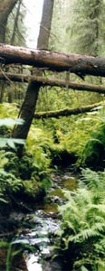
Russian old-growth forests – where they are located?
Old-growth forests protection has always been one of the priorities
of the Russian conservation movement. However, it is difficult to
protect them without knowing where they are located.
In many cases the luck of information about old-growth location
resulted in missing the most valuable forests unprotected, while the
protection status has been applied to less valuable forest areas or
even only to those ones, which timber companies have voluntarily
agreed to leave for conservation. The last option definitely does not
lead to adequate biodiversity conservation.
The information about old-growth location is also important for
timber companies, which would like to avoid environmental conflicts
and introduce environmentally responsible forestry. The
Karelian case study
has clearly shown this.
Here below we listed a few successful attempts to apply analyses
for identifying relatively little-disturbed forest ecosystems on the
regional and interregional levels are known in the Russian
conservation movement:
-
European Russian North
The mapping of only the largest (more them 100 thousand hectares)
massives of little-disturbed forest in European Russia. Made by the
Forest Club organizations (Biodiversity Conservation Center,
Greenpeace Russia, Socio-Ecological Union) in 1999.
The following regions have been covered: Murmansk oblast',
Arkhangelsk oblast', Vologda oblast', Perm' oblast',
Karelia Republic, Komi Republic and Komi-Permjatsky
autonomous okrug.
The LAST Intact Forest Landscapes of Northern European Russia
Alexey Yu. Yaroshenko, Peter V. Potapov, Svetlana A. Turubanova
Mapping of intact forest landscapes in northern European Russia using high-resolution satellite images - methods and results
- Atlas of Russia’s Intact Forest Landscapes
-
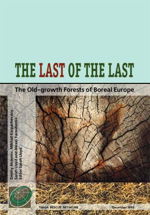 The Last of The Last: The Old-growth Forests of Boreal Europe
by Dmitry Aksenov, Mikhail Karpachevskiy, Sarah Lloyd, and Alexei Yaroshenko
Editor Sarah Lloyd Moscow. Taiga Rescue Network. 1999.
The Taiga Rescue Network report and maps of the old-growth forests of Northern Europe.
This publication is the result of the Old-growth Mapping Project conducted by a number of the TRN
participants over last few years. It includes the old-growth forest maps of Northern Europe covering four countries:
Finaland, Norway, Russia, and Sweden.
-
The Last Frontier Forests Report
issued by World Resources Institute in 1997. The report
also cover the whole Russia. The rather general map represents
only areas more then 4 tousands sq.km. in size without anthropogenic
infostructure. This map is good only for general overview.
Some more earlier historical examples also include:
-
1984-87 - Analysis of the little-disturbed forests remained in Nizhny
Novgorod Region conducted by the Druzhina (Student Corps) for Nature
Conservation of Nizhny Novgorod State University, and then by the
Dront Ecological Center. This analysis became the basis of the entire
program of biodiversity conservation and protected areas networking in
the region.
-
1980s to early 1990s - Search for intact plots of broad-leaved forests
in European Russia. Made by the team of the scientists from different
institutions. Now the core of the team works in
Putchino State University.
One of the results of this work was the creation
of the Kaluzhskie Zaseki (abatis lines) Zapovednik (in Kaluga Region),
which preserves a unique tract of little-disturbed broad-leaved
forests.
Back to Old-growth page
|